| The 'Last of Summer' Victorian Chase Andrew McDonald 27th February 2003 |
| Storms on the eastern
ranges on the 25th and 26th were merely a precursor of what was to
come on this Thursday, the 27th February 2003. The models were initially
predicting rain for Thursday but as each run went by this was looking less and less
likely. This day was always going to go off if there was no cloud and after chasing the
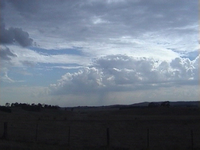
storms on the ranges the previous night, it was clear that there was going to be no cloud.
The weak trough sitting over the ranges (that had been the trigger for the storms on the previous two days) was to combine with a stronger system coming in from the west as well as a strong thermal trough. The models were forecasting the trough to move through western Victoria by early morning and by mid morning be sitting from about Melbourne to Echuca. The southern portion of the trough was then expected to move through S Vic quite quickly but the northern portion was expected to stall across the northern country until late Thursday night. The greatest instability was expected along the ranges to the E of Melbourne but moderate instability also extended along the trough back to Melbourne and north to Echuca. Shear was expected to improve throughout the day as the upper trough started to come into the region from the west. The day was clearly looking good for severe storms. Warm surface temperatures (in the high 20’s/low 30’s were expected) and some moisture (with DP’s in the mid teens) combined with the increasing shear and cooling upper levels all pointed to a good outbreak of severe storms. I had some errands to run first thing in the morning and while I was out, I could see plenty of instability in the sky with TCu, Alto Cu and even a Cb to the NW. A line of cumulus and showers to the west of Melbourne had me thinking that the trough was coming through a little earlier than expected. A quick check of radar and lightning tracker when I got home proved to have some interesting features. A large storm complex over the NE of the state (Cobram - Albury) had a Severe Thunderstorm Advice (STA) issued for it and was producing quite a bit of lightning. The line of Cu to the W of Melbourne also showed up on radar and a cell on the N end of the line near Bendigo was up into the 40-100mm/h intensity on radar and also had a few lightning strikes. I decided that that would be my target cell to start with but given that it was only 9am, it was clear this cell wouldn’t be the best one of the day (at least that’s what I hoped). Shear for the day indicated that most storms would move in a SE’ly or ESE’ly direction so I headed N along the Hume Hwy towards Kilmore to intercept this storm as it drifted down from the NW. A few of the cells in the line to the W intensified a little as they drifted towards Melbourne and I spotted a few CG’s out near the airport. I got to Kilmore a little after 10am as the cell drifted across the ranges to my NW. I had a good view from the W right around to the N and around to the SE. I watched the storm to the NW for about half an hour but it was weak and didn’t look like doing anything overly impressive. A small line of Cu started to develop over near Seymour about 15 mins after I arrived at Kilmore and within 20 minutes it was a fully developed Cb with a nice back sheared anvil.
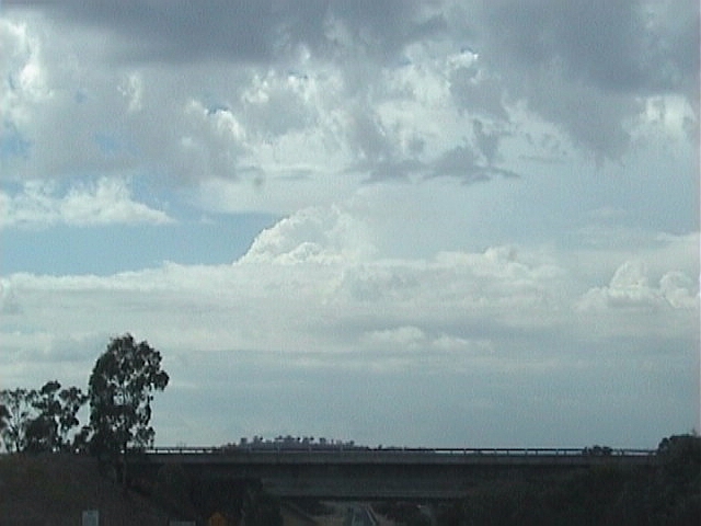
At about 11am I decided I’d watched this Kilmore cell enough - it was weak and was never going to do anything more than produce a few rumbles of thunder and some light rain - so I moved on. The only option at the time was to head up the Hume Hwy to Seymour. I was still thinking the trough had already crossed southern Victoria as far E as Melbourne and I thought I may have to chase in the ranges again. I decided to head to Seymour to re-assess my options. Given that I figured the trough was sitting in a line due N of Melbourne, I thought I’d have to get further east and as such, Benalla/Wangaratta area was going to be my next port of call. An impressive cell developed on the ranges to my ENE near Benalla and rapidly became an intense storm. I decided against chasing this cell for two reasons; the first being it was moving into an area that was not really susceptible to chasing and the other reason being the line of boiling cumulus to my NW and W.
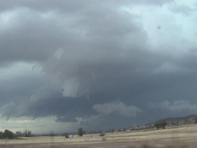
My brain started to click. As mentioned earlier, the models were forecasting the trough to stall across central Victoria and of course, this line of Cu was marking the trough. It was all starting to make sense now. Obviously, the strong instability, the weak cap and the lifting provided by the ranges was responsible for kicking the storms off near Seymour and Benalla and a weak mid-level trough was responsible for the early convection in the far NE of the state. As forecast by the models, the southern portion of the trough was moving slowly across Melbourne whilst the northern portion stalled across the centre of the state. As the cloud from these early storms cleared off to the east, a warm, humid and well-primed air mass lay in the path of the trough. I quickly re-assessed my position and upon reaching Violet Town I headed NW towards Shepparton with the idea in mind that anything that developed along the trough would rapidly intensify. By 12:45pm things were starting to look awesome. The line of bubbling cumulus was really kicking off - more so in three particular areas, two of which had already formed storms. One to my NNW was visually the strongest, the next one S along the line was to my NW and was also quite strong and the one to my WNW was just getting started. I stopped just S of Shepparton for a few pictures of these cells and I also noted the cell back to my SE near Benalla had exploded. A strong updraft, persistent overshoot and thick, solid anvil indicated the strength of this cell.
I called Anthony Cornelius (AC) for a quick update on the three cells in an effort to choose between them. The cell to my NNW was about 100km away and was nicely red (100mm/h+) on radar, the cell to my NW was also red on radar and about 70km away and the cell to my WNW was about 25km away and was up to pink (40-100mm/h) on radar. Observations at Shepparton at 1pm were 32/15 - it was primed to go off.
I cruised through the back streets of Shepparton heading N but I soon noticed an extremely solid updraft pushing up on its NW flank. I changed my target cell (for now) to this closer cell and I cruised back through Shepparton with the cell just to my SW. I could see hail falling out of the top of the updraft and falling back into the updraft near the bottom - but there was no precipitation underneath. At this point I was expecting the cell to contain some larger hail.
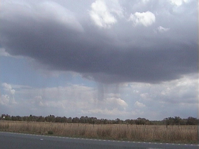
I stopped about 2km S of Shepparton and about 2km from the base of the storm. It still had hardly any precipitation. I heard a few rumbles of thunder from the anvil overhead and realised that I would need to be about 1km further S to be about as close as possible to the storm. I moved S as the first cascade of precipitation started to fall out of the cell about 2km away. I was now sitting right under the edge of the base and looked up to see some weak rotation in the cloud base above my head. It was rather interesting but it was never looking like producing anything.
There were no CG’s for ages but the in-cloud lightning was increasing rapidly as thunder was now constant. The precipitation was now only about 100m to my SW but didn’t look like getting any closer to me so I jumped in the car and headed S along the Goulburn Valley Hwy for about 500m into the precipitation to see what it was like. I was greeted by a wall of rain which was easily 100mmhr+ and some moderate outflow winds (about 40 - 50km/h). I pulled over and after about 2 mins I encountered some small hail to about 1cm. It didn’t last long so I headed back N as the cell now looked a little overcooked (not doing much). As I drove N to the edge of the rain I encountered some slightly larger hail with heavier rain. It was very sparse and the largest stones were about 2cm. Again it didn’t last long so I headed back to the place I had stopped earlier about 2km S of Shepparton. Whilst I was driving I saw a small mid-level funnel. These are not uncommon on days of high instability and high shear.
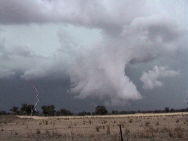
As I cruised back N, I saw the cell to my NW and WHOA!!!! The cell had two separate updraft areas - one was visible to my WNW and the other hidden by rain to the NW. It was extremely dark and I saw 3 CG’s pulse within quick succession. My excitement levels rose rapidly so I stopped and started shooting video. I turned around to see the cell I had just been in moving off to the SE and this also had an impressive updraft on the back end. Of course just as I moved the video away from this, an awesome clear air CG ripped out the back of the cell and down the back of the rain curtain, hitting just 1.5km to my SE. Talk about awesome!!!!!
My attention was quickly drawn back to the NW. The two rain shafts were now separated by a big dark base and a lowering rapidly developed on the S side. Both storms began to put out a barrage of CG’s - especially around the lowering. These CG’s were awesome with each one pulsing several times and some hitting well out in front of the storm. It was moving rapidly towards me so I headed E about 2km to find a good place to set up and video the cell as it approached.
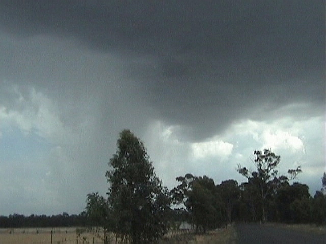
In the three minutes it took me to move, the cell went green and the lowering had intensified into a beefy wall cloud which was slowly rotating. A massive rain core dumped down right behind the wall cloud causing it to become an outflow feature within minutes. This intense are of the storm was fortunately going to pass just S of Shepparton as if it had passed over the town itself it surely would’ve caused much more damage. To my NW, a massive rain foot was sticking out in front of the cell pushing outflow scud rapidly over Shepparton. CG’s continued to pour out in front of this cell and when they started to hit within 1.5km I retreated to the car. The cell was now becoming somewhat linear to the S of Shepparton and dust was kicking up along the outflow.
The outflow hit me at about 2:40pm with gusts to about 60km/h and some moderate rain followed. The heaviest rain was going to pass to my S and I decided to head N to try and pick up the N edge of the storm where, hopefully, some new development would be taking place. I headed N for about 5km, driving out of the storm, before heading E towards Dookie. My hopes became reality as I started to get views of fresh development on the N end of the cell. I was behind the updrafts (on the NE flank of the storm) and they started to precipitate heavily. I knew I had to push through them to get to the development on the other side and in doing so, I encountered more torrential rain (possibly the heaviest of the day) and some more small hail (again only to about 1cm). This cell slammed me for about 10 minutes before I drove out of the other side near Dookie but I continued to push east to get myself in position for the new updrafts on the N end of the line (now just to my S). I started to notice the CG’s again as they were still frequently pulsing well ahead of the storm. Scud lowerings rapidly developed under the base. At first I thought it was outflow but it soon became clear that this was a developing wall cloud. It developed a short, disorganised inflow band and became quite low to the ground. I couldn’t believe what was happening before my eyes. It was 3:35pm and the wall cloud had rapid upward motion that was clearly visible to the naked eye. CG’s were pulsing all around this region and thunder was constant. A green tinge surrounded the wall cloud as it developed even lower to the ground - I estimate no more than about 200ft off the ground.
I only noticed later when watch the footage that a small funnel developed in the region where the strong upward motion was taking place. It lasted about 30 seconds before it was enveloped into the wall cloud. Only a few second after losing sight of the funnel, a brief spin-up occurred under the wall cloud, lasting around 10 seconds or so. Dust is clearly visibly rotating as it is kicked up but I don’t think the funnel and the dust were directly linked.
Only minutes after this, the whole feature was undercut by outflow so I moved on again. The storm rapidly became totally outflow dominated as no fresh growth developed on the N end of the cell. I called AC for a quick update and I headed from Benalla to Mansfield in the hope I could catch storms near Seymour which were showing up strong red echoes on radar. Unfortunately, as the day got later, shear got better, meaning storms were moving faster and faster. I did my best but this storm made it into the unchaseable E ranges areas and it got away. I was later to hear unconfirmed reports of golf ball sized hail from this storm near Seymour and it passed out to sea near Yarram in South Gippsland after maintaining its strong intensity for over 2.5hrs.
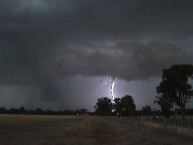
I eventually made it back home via Marysville and Healesville at around 7:30pm as the only convection remaining was weak looking TCu over the ranges. I scoffed a quick dinner (I was starving as I hadn’t eaten since breakfast) and jumped online eager to tell people about my awesome day. There was only one problem with this - the area around Seymour had just exploded with storms which had gone from showing nothing on radar to the highest intensity in just 20 minutes and within 30 minutes, the main storm had split. I was out the door in a flash. I headed up to Mt Donna Buang (via Kinglake and Healesville). At Mt Donna Buang I was treated to an extremely impressive lightning show. Flashes were going off every 2 seconds or so with crawlers, CG’s and in-cloud flashes lighting up the awesome structure of the storm. Unfortunately, this show only lasted about 10 minutes as low cloud and fog drifted in as the S’ly behind the trough drove cold, moist air onto the ranges. The lightning was still visible through the cloud and quite a few CG’s were still popping out but it wasn’t quite as good as it had been only minutes earlier. I did manage to catch a few CG’s which emerged from the low cloud only to have them disappear into the even lower cloud deck below where I was standing.
I eventually got home after midnight and I went straight to bed - I was totally exhausted. Given that this season has been one of the worst on memory for storm chasers here in Victoria, this was one of my best chases for the season. Come to think of it, I’d even put it up there in my top 5 chases of all time. It was a great day and I thank those who provided me with updates throughout the day and helped in my communication with the BoM. I hope the information provided to the BoM on the day and in this chase report was/is useful to them in issuing and verifying warnings. |