| So we pull
the pin at Pampa after a 15 hour stormchase left us panting...we set off early bound for
the 4 corners regions (that's where you can stand on one toe and be in 4 states at one
time - Colorado, New Mexico, Arizona & Utah - brings the total number of states
visited to 17 in a month). Before we left we didn't listen to the NOAA weather radio for
alerts - we turned it off....we didn't listen to the hoopla from The Weather Channel, and
we didn't do a weather analysis. If anything happened in Texas on the day we left we
didn't want to know about it. We travelled
west on the I-40 passing into New Mexico, and our plan was really just to travel (with a
bit of sightseeing). No sooner had we entered New Mexico, than we spotted a brand new Cb
off to the NW....it's only 10am! If you;'e a genuine stormchaser and you see something
like that, you just want to chase more. So we alter our route - instead of running west on
the I-40 all the way to the Arizona border, we deviate at Albuquerque (that's the place
where Bugs Bunny made a left turn and ended up in Africa). We eventually arrive in the
late afternoon in far northwest New Mexico - the road rises gradually before Albuquerque
and the city has a backdrop to a spectacular range of mountains.
We notice some of the congesting Cu are glaciating
at a low altitude - even dropping showers. But this is an illusion.....especially when you
realise that you are already 7,000' ASL. These showers / storms are high based stuff and
we estimate their bases around 13-14,000'. The best towers tend to grow over high ground
and produce spectacular anvils in their weakening stages. We soon also realise that their
precipitation tends to be predominantly virga. We continue north into Colorado for a look
around Durango - here, some of the storms are looking really good! Durango is a congested
tourist mecca and we flee west to Cortez.
In this part of the world, the countryside is
spectacular. The upland meadows are a brilliant green, while the valleys become semi arid
scrubland. The backdrop of Hesperus Mountain between Durango and Cortez (~13,200'), still
snow capped after a chilly spring over much of the Rockies was breathtaking. We approach
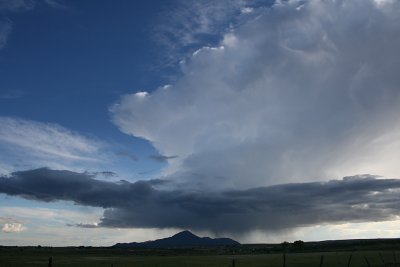
Cortez and see a brilliant display of a multicell maturing virtually over the town. To the
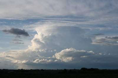
north, another large multicell matures, and we are again in storm heaven.
Report: Clyve Herbert
Photography: Jane ONeill / Clyve Herbert |
 Spectacular silhouetted multicell, Ute Mtn, Cortez |
 Strong pulse north of Cortez late evening. |