![]()
![]()
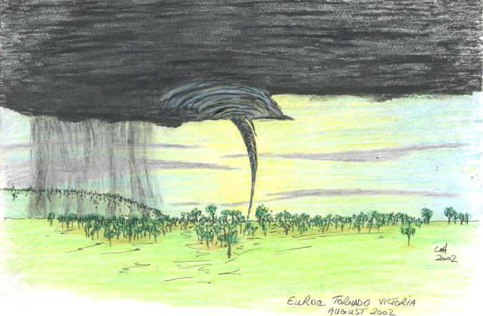
Euroa Tornado
Victoria, Australia
3rd August 2002 Images: Jane ONeill
Imagery, analysis & discussion
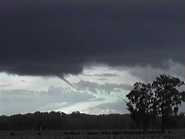
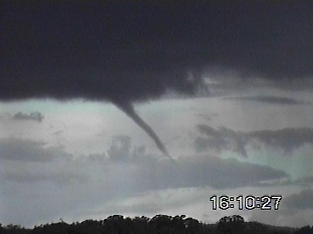
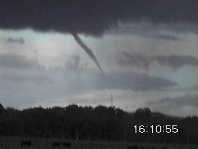
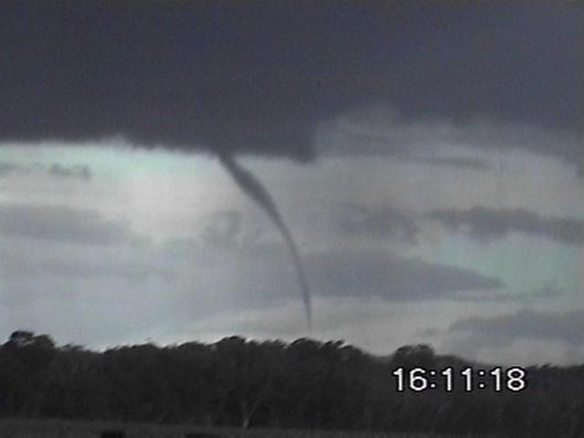
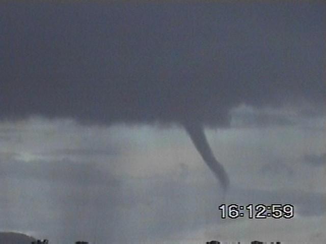
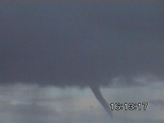
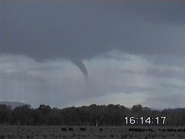
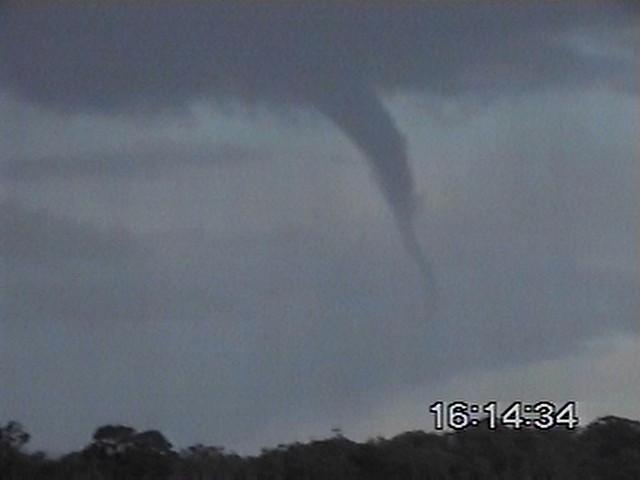
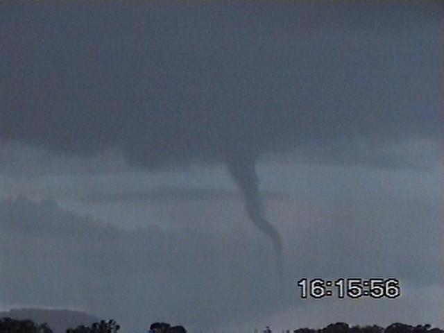
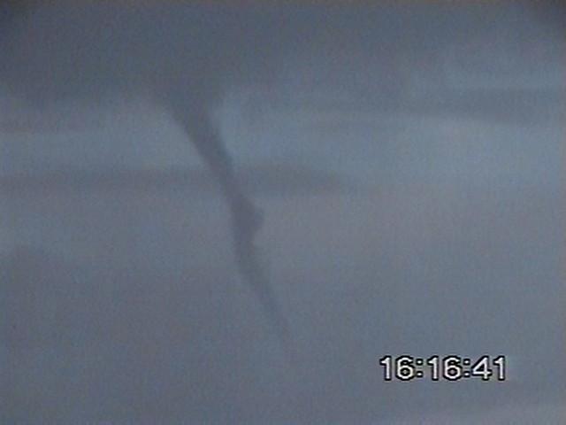
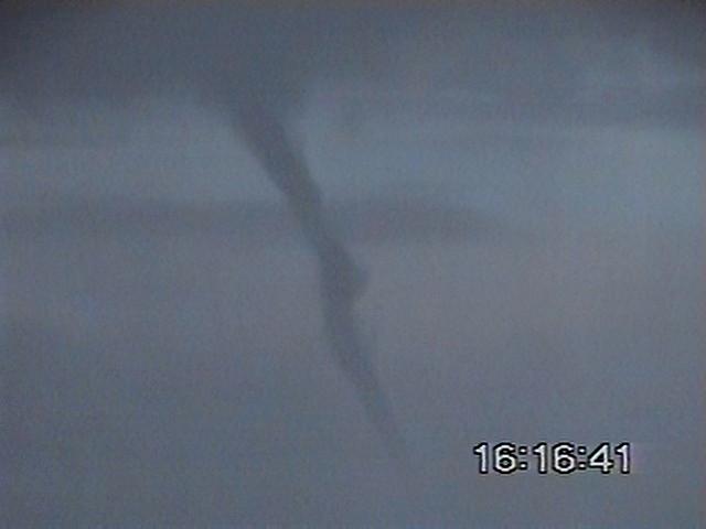
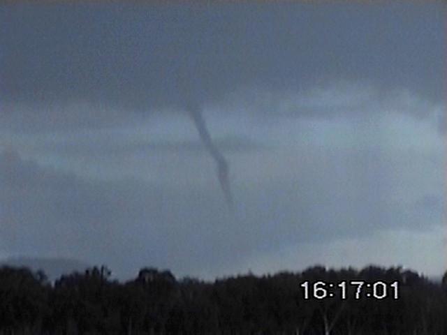
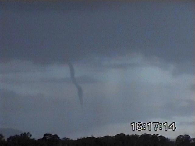
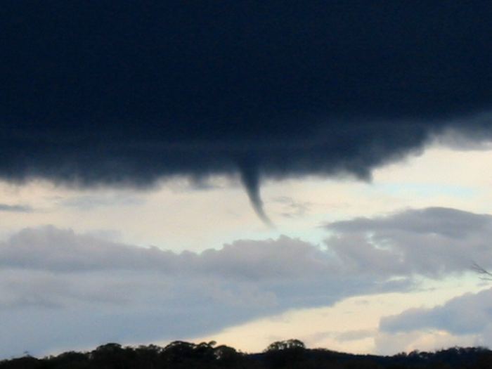
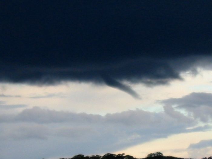
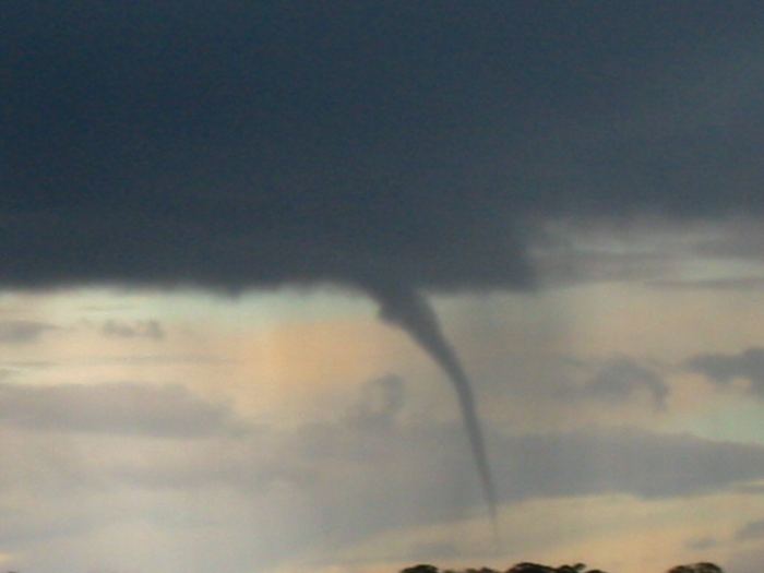
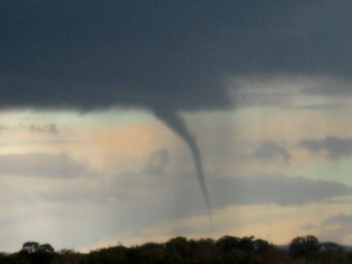
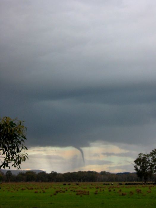
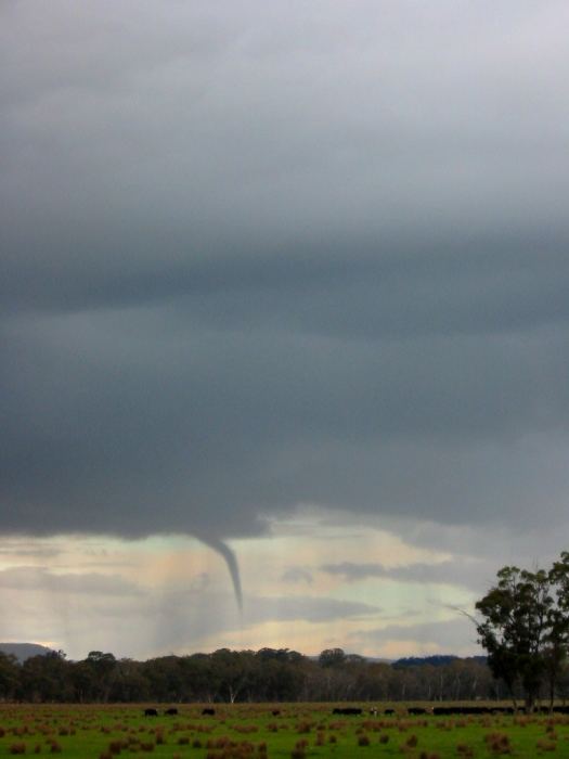
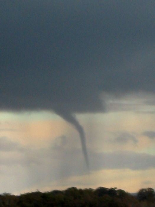
Saturday 3rd August 2002 was going to be a good day! The upper trough over southeastern Australia was amplifying with both an upper low located near Kangaroo Island and a surface low likely to develop near Mt Gambier. I spent the Saturday morning pottering about and keeping an eye on conditions while waiting for the 12.30pm updated satellite image - I already knew I was going north, but wanted to confirm the situation before I left (the last satpic had been 9.30am). The satpic showed that the upper low had moved into southern New South Wales, there was a complex trough over Victoria and a look out the window to the southwest showed some interesting development. Out the door at 1.15pm..... Managed to get a full 3 kms from home, stopped to get petrol and spent the next 20 minutes monitoring (and photographing) a convergence line moving across the eastern suburbs of Melbourne complete with suspicious ragged lowerings. These certainly piqued my interest, and I wondered what conditions might be like in the northeast of the state, closer to the upper low and ahead of the weak trough I had just photographed. I began to see congesting cumulus near Seymour as I headed north, and I monitored the development of a multicell that I picked up west of Seymour as it tracked northeast - conveniently parallelling the highway. Stopped to take a few photos and noticed ragged lowerings which looked suspiciously funnel - like, but this storm was too far away at that time to be able to see detail clearly. An intercept with this cell looked possible, so I continued northeast keeping one eye on this cell to my left (west) and watching another smaller developing cell to my right (east). Just south of the Euroa turnoff came the "there's a cell on my left and a cell on my right.....and I'm in between them...which way to go???" 5 second decision making game...I turned off the highway towards Euroa, glanced to my right, dragged the steering wheel to the left with one hand while digging digital camera & video out & turning them on...I stopped the car, was across the road (dodging people riding past on horseback) to get a better view of a funnel starting to form from the cell to the east of the highway....a significant funnel extending about 20% to the ground developed within a minute or so. A few digital images were taken and some shaky video while the funnel began to weaken, but it never quite dissipated. I shot back across the road to get the tripod - and couldn't find the fitting for the bottom of the video.....so back across the road to spend the next 9 minutes taking photos, video and watching the development of not just a funnel, but a weak tornado. The duty forecaster at the Bureau of Meteorology in Melbourne that afternoon certainly wasn't expecting my phonecall reporting what appeared to be the development of a significant funnel near Euroa, let alone having a storm spotter shouting in his ear with excitement as a condensation funnel developed all the way down to behind the trees 3 kms away while I watched and videoed!! He asked if the cell had any lightning - I said "no" seconds before lightning exited above the wallcloud and re-entered the cloud just below!! What had appeared on radar at that point to be a congesting cumulus on the southwestern edge of a retreating area of moderate instability had just dropped a funnel / tornado as well as lightning!! I captured 9 minutes of video from the very beginning of the development of the funnel, through the development of the condensation funnel - the funnel and tornado lasted more than 14 minutes before dissipating slowly to the east of a heavy rain area, lifting from the ground and trailing off to the northeast, while still extending at least half way between the cloud and the ground. Any effects from a circulation on the ground was well away from the road network and across open paddocks - I am not aware of any structural damage reported, but I doubt that damage consisting of broken branches or ploughed up back paddocks would be reported to the authorities. |
||
|
Images above taken 1604AEST
Images above taken 1605 & 1606AEST
Images above taken 1607 & 1608AEST
Images above taken 1610 & 1612AEST
Images above taken 1612AEST
Images above taken 1612AEST
Images above taken 1612 & 1618AEST Video captures (below) |
||
 |
 |
 |
 |
 |
 |
 |
 |
 |
 |
 |
 |
 |
 |
 |
 |
 |
 |
 |
 |
 |
|
 |
 |
 |
 |
 |
 |
 |
 |
| RADAR IMAGERY Animation of PPI (1510 to 1710AEST) - Euroa is in the SW quadrant outside the 50km circle (EUR) RHI images: 1610 & 1620 AEDST (courtesy of the Bureau of Meteorology)
|
|

1000MSL |

|
| SATELLITE IMAGERY
|
|

1230 Victorian visible
|
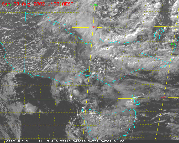 1430 Victorian visible
|
 1230 Victorian IR
|
 1430 Victorian IR
|
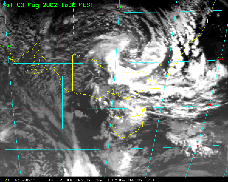 1530 Victorian IR |
 1830 Victorian IR |
| SOUNDINGS
|
|
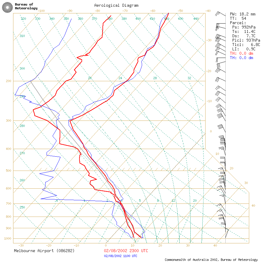 9am Melbourne sounding |
 9pm Melbourne sounding |
|
3pm Melbourne hodograph Download the HodoTool - Java applet zip file here courtesy Hank de Wit |
|
Thanks go to the Bureau of Meteorology, Kevin Parkyn, Robert Goler, Clyve Herbert, Hank de Wit, Greg Hughes and Troy Spencer for helping collect the information & provide images that appear on this page.
If you have any information about this event, please contact me at [email protected]


