presented by
Most current situation analysis (AESummerT = UTC +11) |
|
|
|
Upper Analysis Charts - 500hPa
500hPa chart: The contours are the 18,500' (500 hPa) height field which indicates air flow at that level as well as the overall thickness of the atmosphere between the surface and the 500hPa pressure. The 540 line is marked in black. Updated daily at 0Z & 12Z.
CAPE & Precipitable Water
Upper Analysis Charts - 850hPa temperature, humidity and wind
|
Upper Analysis Charts - 500hPa Geopotential Height and Vorticity
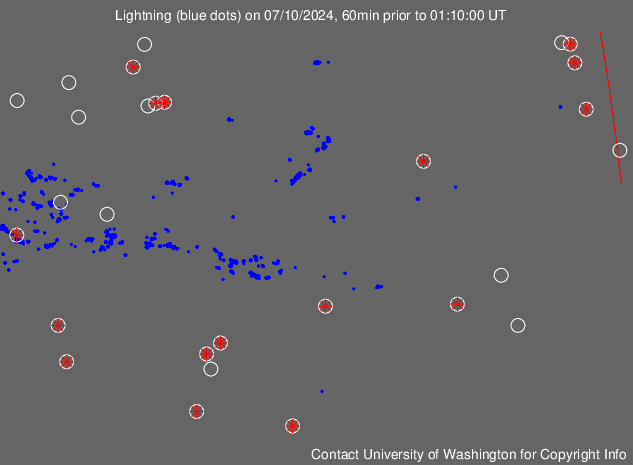
Lighting Detection - Pacific region
|
To join the Austral/Pacific weather mailing list, click here
|
|
|
|
Thanks to The Bureau of Meteorology, Cooperative Institute for Meteorological Satellite Studies, CSIRO, LF*EM Research, EUMETSAT, Dundee University, IGES, University of Otago, SSEC Wisconsin, Weatherzone and Unisys for allowing use of the images. |
|
� Australian Sky & Weather 2013. The information provided on this website should not be relied on in lieu of officially disseminated weather forecasts and warnings. This site is a means for disseminating weather information through the Internet to a broad range of users.
![]()

This page is sponsored by Australian Sky & Weather - The fully independent private forecasting group. �2000-2013