| I was making a mad dash from America
to Australia to join the celebrations of my oldest son becoming a train driver. I was
going to spend 1 night in Melbourne and return to America the next morning. In the waiting
lounge of Qantas LAX T4 it took almost an hour to load up the behemoth A380 - amongst the
fussing crowd and screaming kids, I thought to myself..this couldn't possibly get any
worse....but of course the story wouldn't be worth anything if it didn't get any worse....
I spotted the fat, bald guy waddling up the aisle carrying 2 overloaded cabin bags - there was more gold hanging off him than an Aztec reunion! He squeezed into the centre seat pushing me up against the window - the distinct smell of urine emanated from his seat. His pretty little wife sat on the aisle seat. For the next 15 hours I put up with belching, farting and snoring (and not from me). To take my mind off things I tried to peer out of the window at any cloud structure I could see as the plane climbed to 32,000'. The huge A380 doesn't take off with necksnapping acceleration...it just seems to ease its way into the air, almost uncomfortable with its own presence. But these QE2's of the sky are smooth sailers. Peering out of the window made no difference because I was looking at a massive wing...I wasn't distracted from my neighbour at all and I noticed another stench that mixed with the rest of it and that was stale tobacco from his breath. But back to the wing for a second, the A380 wing is built in Bridgend, South Wales...and I feel a weird connection...because that's where I was born. But this article is about weather primarily, but one more thing to say about my neighbour in the middle seat.....after landing in Melbourne, 15 hours and 35 minutes later, he pulled his fat arse out of the middle seat and squeezed out into the aisle...letting go a fungus smelling fart that startled just about everyone within 10 feet....!!! After the celebrations of my son's party and a couple of hours sleep I was lined up again at Customs departing Australia en route to LA and back to storm heaven country. At 1.30pm I was getting off a plane at Denver where Jane picked me up after 20 hours travelling. 3 hours later we were mixing it with one of the best supercell thunderstorms I'd ever seen! As we headed north from Fort Morgan, Colorado towards Kimball, Nebraska, a line of cumulus that we'd spotted at Denver airport had already grown into a band of weak storms. Northeast Colorado and SW Nebraska are elevated locations, with some places exceeding 5,000'. The dynamics of storms here can be quite different to the lower level plains - with our dewpoints barely registering 50F/10C, you would normally need something like 10,000 tonnes of dynamite to kick storms off anywhere else....but here with the right forcing, the presence of a dryline, an approaching complex cold front and colder air coming in at higher levels, the formula at these altitudes can work well. We noticed one of the cells suddenly showed a massive eruption of an updraft on its SW side, and within a short period developed a beavertail. The updraft rotated to produce a weird donut appearance as it bounced under the tropopause. A huge anvil was being generated and spreading northeast, obviously influenced by a reasonable amount of shear about 40,000'.This first storm developed supercell status and approached Kimball. A wall cloud developed over Kimball and rotated strongly for about 5 minutes. As far as we knew, we were the only stormchasers in the area at that time, and being listed on the Spotter Network we received a call from Cheyenne, Wyoming National Weather Service office and we spent the next 3 hours sporadically describing the setup in the Kimball area. As the first supercell rotated across Kimball producing walnut hail, a second even larger storm was developing about 30 miles to the southwest. We drove to a hilltop to photograph and video both storms. As the first storm moving east of Kimball weakened, we headed SW to intercept the 2nd storm which had now developed a large wallcloud. We noticed lowerings and fractocumulus rotating near the base - the storm was becoming distinctly tornadic. We confirm the funnels and brief touchdowns to the NWS in Cheyenne, and within minutes, the sirens in Kimball scream! In some regards, the storm was a right mover but we noted that it was being undercut by its outflow. We are pummelled by large hail and head east to pace the storm along Interstate 80. In a weakening phase, we figured that maybe the storm was now going to die, but as usual with storms on the high plains....always expect the unexpected. The former mesocyclone and main updraft was riding the nose of an outflow and it strengthened into a spectacular LP supercell. We pace the storm to Sidney, Nebraska and watch it disappear within minutes when the sun set. Footnote: as a further reference to my smelly neighbour in the next seat...he was emigrating from El Salvador with his wife...when justice would have it Customs bailed him up - they weren't happy with the food items that were jammed in his suitacase. I was overcome by an air of satisfaction...try farting in front of those guys you brute!! |
|
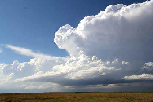
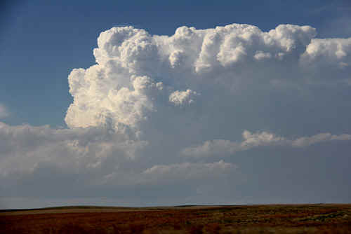 The massive updraft bloms on a boundary (weak dryline) SW of Kimball, NE. Photo: Clyve Herbert |
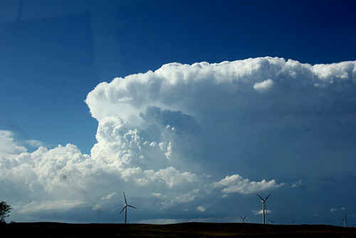
Photo: Clyve Herbert |
 The updraft became focussed on its SW flank. Photo: Clyve Herbert |
 The storm develops at a high altitude, approx 5000'. Photo: Clyve Herbert |
|

|
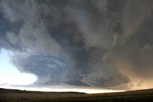
 The storm was showing strong rotation in the midlevels (refer Cheyenne doppler). Photo: Jane ONeill |
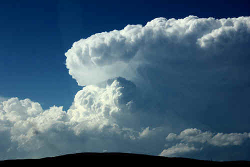
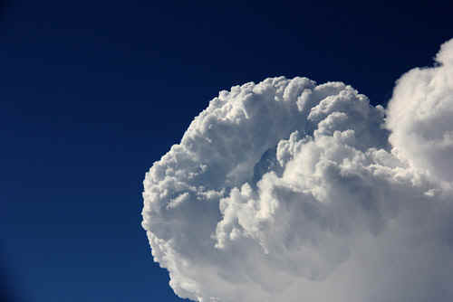
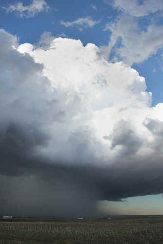
 This is a good example of the main updraft core over the developing mesocyclone nearer to the surface. Photo: Clyve Herbert |
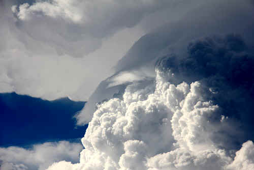
 This is the closeup view of the developing 'donut' - the strong updraft appeared to be rotating, note the concave feature in the centre. Photo: Clyve Herber |
 This has got to be one of the strangest images of an updraft that we have ever seen!! It appears the enire pulse is rotating, leaving a deep hole in the cente. We wouldwelcome discussion on this image. Photo: Clyve Herbert |

Eventually the rotating updraft spreads out into a strong backshear. Photo: Clyve Herbert |
 The supercell develops a massive anvil spreading quickly northeast. Photo: Jane ONeill |
 Closeup example of the main updraft core showing pileus. Photo: Clyve Herbert |
 Looking NE along the edge of the dense anvil. Photo: Clyve Herbert |
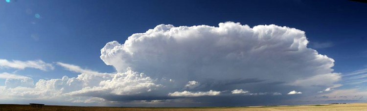
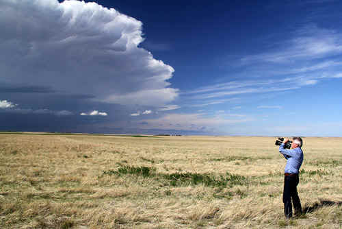
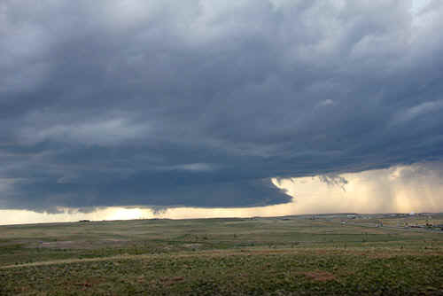
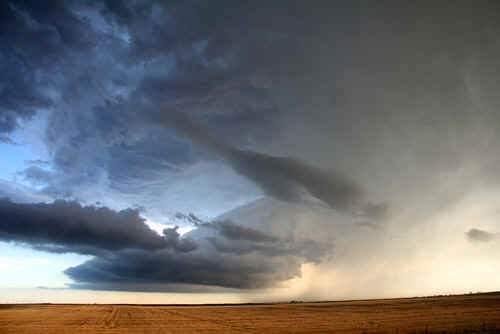
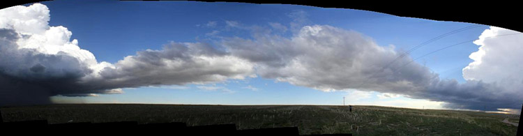 Later in the afternoon, the initiating supercell is connected to a second developing supercell. The connection is made by a boundary which can be seen joining the two storms. This panoramic image was taken looking to the south from Kimball. Photo: Jane ONeill |
|
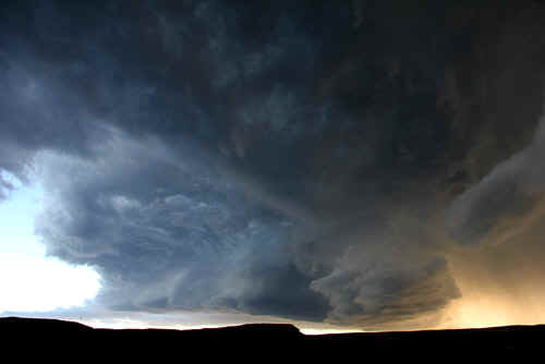
The mesocyclone moves over Kiball and was rapidly rotating. The storm dropped walnut sized hail across the town. Also in this image, the mesocyclone is starting to wrap rain/hail into its updraft core. Photo: Clyve Herbert |
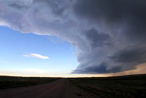
 As the first supercell weakens, a second larger supercell develops to the SW of Kimball. Photo: Clyve Herbert |
 Meanwhile the first storm of the afternoon was moving east and weakening...Photo: Clyve Herbert |
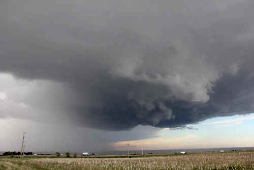
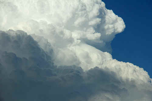
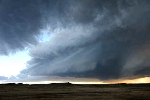
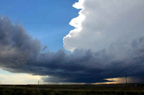 The immense storm to the SW of Kimball takes on a classic supercell. Note tha large wall area.Photo: Clyve Herbert |
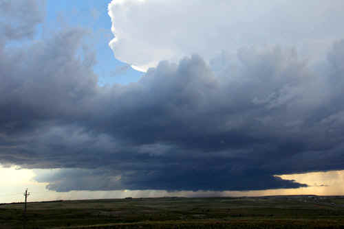
A closeup of the immense wallcloud of the Kimball supercell (No. 2) Photo: Clyve Herbert |
|

This image shows a persistent dome funnel on the right side of the lowering. We suspect there was already interaction with the ground. Photo: Clyve Herbert |
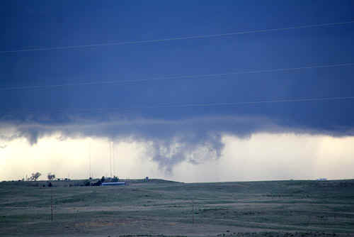
Rapidly rotating columns of condensation reach the ground. We suspect the storm was having difficulty with the outflow and was unable to sustain any longterm tornadic phase. Photo: Jane ONeill
|
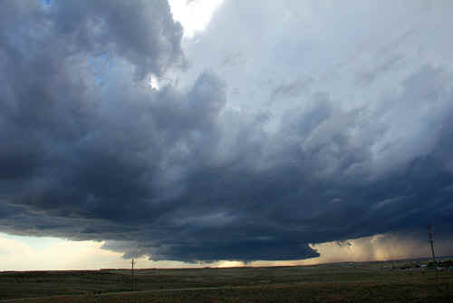
 Communication with Cheyenne NWS at the time of this image indicated strong and rapid rotation within the storm. Photo: Jane ONeill |
 For several minutes there was an intensification of rotation near ground level. Photo: Jane ONeill |
 A closer view of the wallcloud structure, rotating vapour columns would appear and disappear very quickly, and had a tendency to move left and right through the wall area. Photo: Clyve Herbert |
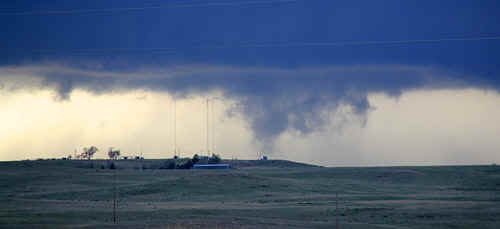
 Over the next 30 minutes we note that outflow starts cutting into the wall area. Photo: Clyve Herbert |
 There's nothing like being up close and personal to a massive strong updraft. Photo: Clyve Herbert |
 This is another image of the eastward progressing storm No. 1 that initially weakened and then regained strength east of Kimball. Photo: Clyve Herbert |
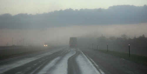
Strong downburst and hail - Interstate 80 - E of Kimball. Photo: Clyve Herbert |
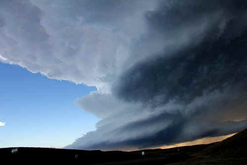
 After the second storm (supercell) went through its tornadic phase SW of Kimball, it became strongly outflow affected. We watched the mesocyclone ride the nose of an outflow boundary and were stunned to see that the storm regained rapid rotation and evolved into an LP supercell SE of Kimball. Photo: Clyve Herbert |
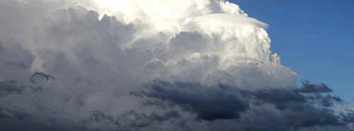
 The storm takes on a cathedral effect as we were standing and looking up into the vault of an LP supercell with the sound of continuous thunder and occasional large hailstones (dime, quarters, golfballs). Photo: Clyve Herbert |
 This is a closeup of the rapidly rotating SE quadrant of the Kimball LP. Photo: Clyve Herbert |
 Panorama of the Kimball LP supercell. Photo: Jane ONeill |
|
 Strong rotating updraft feeds a solid rounded anvil. Photo: Clyve Herbert |
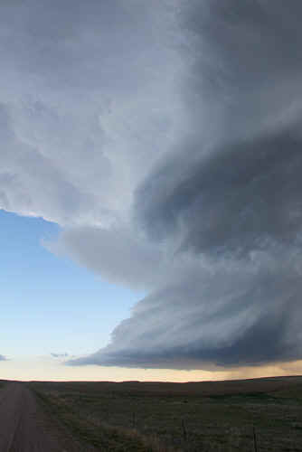
Photo: Clyve Herbert |
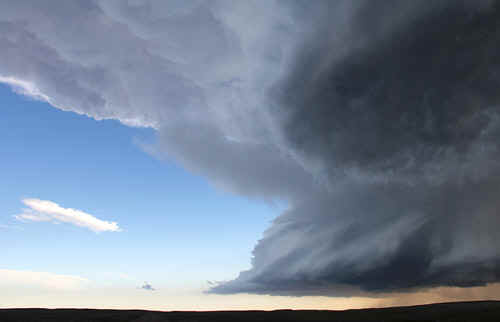 Photo: Clyve Herbert |
 Photo: Clyve Herbert |
 There's nothing like watching a grumbling LP supercell marching across the plainsof Nebraska sparking lightning and spitting hail. Photo: Jane ONeill |
 In the final stages of its lifespan, the updraft column is choked off by occluding cool air. The updraft column disappeared within 5 minutes of this image. Photo: Clyve Herbert
|
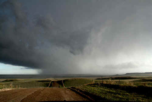 Photo: Jane ONeill |
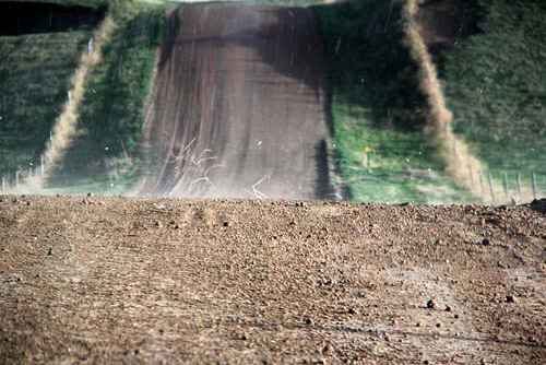 Bouncing hail and blowing tumbleweeds. Photo: Jane ONeill |
| Stay tuned for the next episode... | |