| The climate trends of west Texas were
in transition....most of the region had been suffering an intense drought over the past 12
months, but as nature has it, the shift in spring 2012 was for wetter weather. The region
we overnighted in at Shamrock (eastern Texas Panhandle) was still experiencing the tail
end of a 12 month drought, but as we headed south into central west Texas, the rains had
arrived and we moved from pockets of drought to pockets of flood. Our destination today was south Texas where a stalling cold front straddled the Texas-Mexican border in the Big Bend region. Our decision point would be Sonora on Interstate 10...we would either head southeast to deep south Texas or head west to Fort Stockton. From our past experience, storms would often build on the Mexican high country and border region in far SW Texas. With the right setup, one or two of these storms would make their way onto the Pecos valley, and in the right conditions mix with high moisture and strengthen. This phenomenon doesn't happen all the time and it's always hit or miss in this part of the country. We decide to take the westerly option and head for Fort Stockton...Interstate 10 dissects south Texas and here the speed limit was 80mph, so you can travel long distances relatively quickly. We noted a string of weak cells drifting off the Mexican mountains SW of Fort Stockton. Over the next half hour one of the cells strengthens and remains almost stationery for an hour. Rather puzzled at the stationary status of this storm while other storms weakened or progressed northeast, it took a bit of a geography lesson to realise what was going on. SW of Fort Stockton, the Barrilla Mountains rise abruptly up from the plains to reach heights of almost 9,000'....this storm was anchored orographically. As we made our way west of Fort Stockton, we realised that the road systems here are not so grand. The dirt roads are a mix of rock and a very fine white powder that sticks to everything, and when wet reminded me of the consistency of a barium enema! The high mountains that we were aware of were completely enveloped in a blue-black cloud deck with bolts of lightning striking the ground. We managed to locate ourselves in relatively remote country with inquisitive horses hanging around.Eventually the storm decides to drift off the mountains and head eastward, and we note an interesting gustfront clear the eastern slopes of the Barrilla Mountains. The storm achieves low end supercell status for about 40 minutes with a sporadically rotating wall area, and continued spectacular lightning. We head back to Interstate 10 and pace the storm east over the next hour or so, meeting up with a tour group. As we close in on Fort Stockton the storm weakens fairly rapidly and becomes an elevated rain area. We were happy with our gamble to head west. We overnight at Fort Stockton and meet up with 3 other Australian storm adventurers, Michael Bath, Rodney Wallbridge and Jason Patterson from the northern rivers of New South Wales, and enjoy a nice steak dinner at K-Bobs Steakhouse. |
|
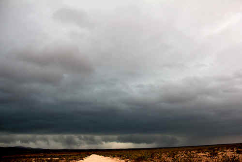
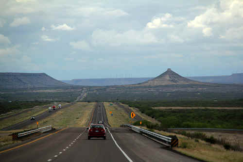 Interstate 10 - road to Fort Stockton, SW Texas Photo: Jane ONeill |
 Photo: Jane ONeill |
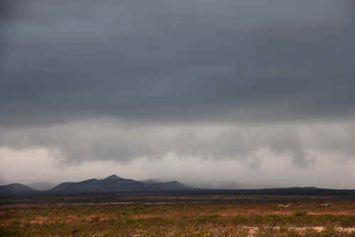
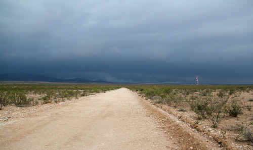 The storm cell anchored over the Barrilla Mountains. Photo: Jane ONeill |
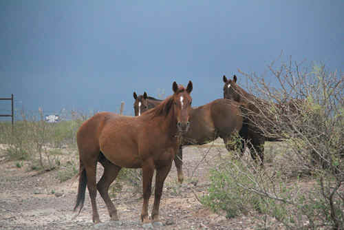 Friendly horses, Barrilla Mountains. Photo: Jane ONeill |
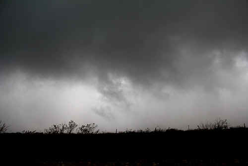
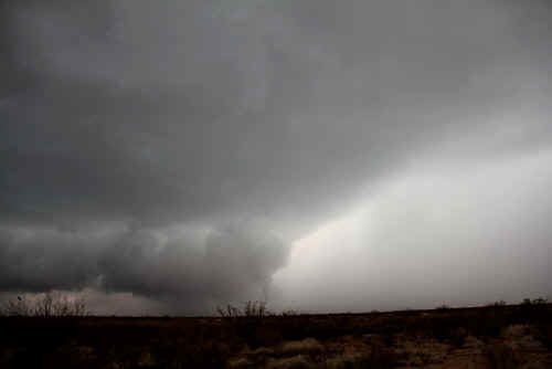
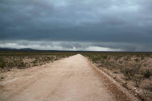 Eventually the storm comes off the mpountain range and heads east across the plains. Photo: Jan |
 The storm had developed a reasonable RFD which was pushing the rain SE from the main updraft core. Photo: Clyve Herbert |
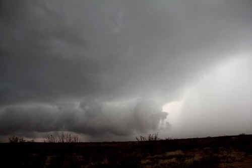
 The outflow boundary was markeded by strong and gusty winds blowing from the SW. Photo: Clyve Herbert |
 Photo: Clyve Herbert |
 Spinup on the outflow. Photo: Jane ONeill |
 Where the boundary was close to the wall area, rapid and brief rotation appeared. Photo: Clyve Herbert |
 Spinup on the outflow. Photo: Jane ONeill |
 Rain and hail mix into the surface rotation. Photo: Clyve Herbert |
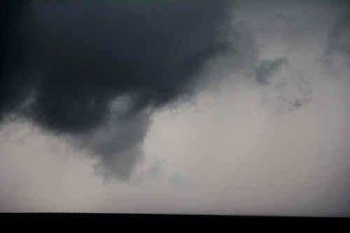
 Occasionally a spinup would send fractus to the ground. Photo: Clyve Herbert |
 The RFD outflow terminated at the wallcloud which was rotating sporadically. The storm was achieveing its highest intensity at the time of this image. Photo: Clyve Herbert |
 A view of the rotating wallcloud WSW of Fort Stockton. Photo: Clyve Herbert |
Photo: Clyve Herbert |
 The wall area tried very hardf but failed to consolidate any significant rotation. The storm was always affected by outflow. Photo: Clyve Herbert |
|
| Stay tuned for the next episode... | |