| Stormchase
22nd May 2009: Lusk, Wyoming supercell Report: Clyve Herbert |
|
| Lamar,
CO to Lusk, WY After a brief analysis and a 2 minute destination discussion, we decide that far NW Nebraska and central east Wyoming was in reach. The relatively moist profile appeared in the area and the cold front was dipping south from northern WY. Other than that, the atmospheric profile appeared rather complicated with a plume of mid and upper moisture being dragged north through Colorado and curving east-northeast across central and southern Nebraska (following the jet). We dash north from Lamar, CO encountering mainly weak mid level showers and continually looking for clear areas to the north. We enter Nebraska under a field of weak cumulus drifting from the southeast. We continue north from Scotts Bluff (NE) to Crawford. The long trip saw us arrive on the NE / WY border late afternoon. To the SE across the Nebraska panhandle, the Cu were struggling, but we identify an alignment of deeper Cu feeding westward towards a multicell storm over east central Wyoming. We follow the alignment of deep Cu to near Lusk, and it's here we plonk and hope for action. The alignment of congesting Cu we were following show a pronounced curve towards the west arcing towards the south about 20 or 30 miles to our west, and feeding into a large multicell complex which appeared to be weakening. Occasional rumbles echoed through the valley as individual cells matured along the line to our west. Our attention was drawn to a separate storm about 20 miles to our NNW which showed consistency in its rain core and lightning frequency. We were interested in the relatively weak cells along a boundary alignment over our heads which showed a westward movement and suspect they may have been forming along a decaying outflow boundary from the central Wyoming multicell complex. The storm to our north however continued to move in a more or less southerly direction and may have been following a separate boundary, possibly the cold front edging southward. Over the next 15 minutes or so we interplayed with a herd of cows who ambled up from the paddock to the fenceline, watched the weaker cells to our west mature and noted continued intensification of the cell to our north. Pretty soon, the storm to our north started dropping lowerings on its southeast flank. It appeared to have an inflow flanking line on its NW quadrant. We decided to have a closer look and drove into Lusk and headed north on Rte 18/85 and stopped with a good view about 3 miles north of the township. By this time, the northern storm was getting itself better organised with more frequent lightning and ragged lowerings on the flanking line on its western quadrant. We were startled by a very near cg and a new large cell was developing almost directly over our heads. The cell over our heads started to precipitate 4cm hail!! and we shifted further north to get away from the precipitation shaft. We now had 2 large cells developing in the area. The northern storm continued to drift south and appeared to merge with the new cell nearer to Lusk. We escape south through the township and head east along Rte 20. The northern cell was now approaching Lusk township and we struggled to escape the increasingly prominent green appearance of the base. We end up about 6 or 7 miles east of Lusk and park to watch the show. We are literally stunned by the rapid intensification of the storm over Lusk, the speed at which it developed a rotating wall cloud and the constant lightning. The storm took on supercell characteristics - we spot what appeared to be a funnel along the wall cloud - it rapidly dissipated. We then watch the wallcloud become wrapped in rain/hail on its eastern side. The entire structure of the storm took our breath away. Another funnel appeared on its northwest quadrant, partially rainwrapped..the storm slowly moved southeast with constant sparks and continuous thunder. We move west towards Lusk and come across a remarkable hail swathe - some hail was washed into drifts almost 3' deep! The hills around the township were coated with what appeared to be deep snow...Lusk had also been affected by significant flash flooding, particularly on the eastern side of town. We head north again and pass through the hail swathe with level depths of near 4". The hail varied in size between 1 and 5" with every conceivable shape you could think of, although mainly a mix of conglomerate, jagged pieces and perfectly symmetrical marbles (large marbles!) We watched truck drivers plough through the hail drifts, vehicles with broken windshields, 4WD sliding off the road, and a hapless biker losing his machine. We watched the storm drift southeast and gradually weaken. We suspect this storm might have been a strong right mover. Emptied of adrenaline again, we drive back to Alliance and rest. Report: Clyve Herbert Photography: Jane ONeill / Clyve Herbert |
|
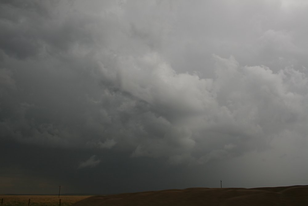
 Long convergence line extending east to west and feeding into larger multicell, central east Wyoming. Note the curve of the feeder line. |
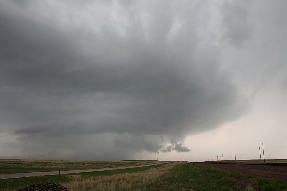
 The primary northern cell approaching Lusk from the north. |
 Southeast quadrant of primary cell starting to interact with inflow feeder band |
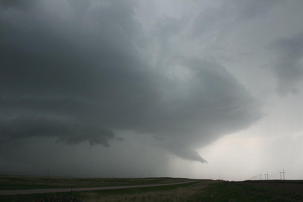
 Storm now over Lusk and wall cloud on the northeast quadrant |
 |
Structure of storm over Lusk - entire storm appeared to rotate. The original convergence band wraps around the northern quadrant. |
 Details of northeastern quadrant base |
 Wall cloud becoming rain wrapped - rotation was cyclonic |
 Lusk is in the centre of the precipitation shaft |
 |
 The storm developed a rotating tail in latter stages of its severe stage |
Structure of northeast quadrant with tail |
 Banded outflow appears on the southeastern quadrant - inflow appeared to favour the northeast of the storm |
 |
 |
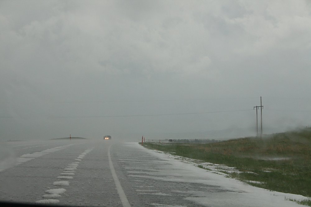
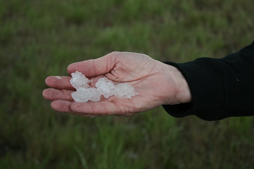
 Rounded hail and jagged hail, Lusk |
 |
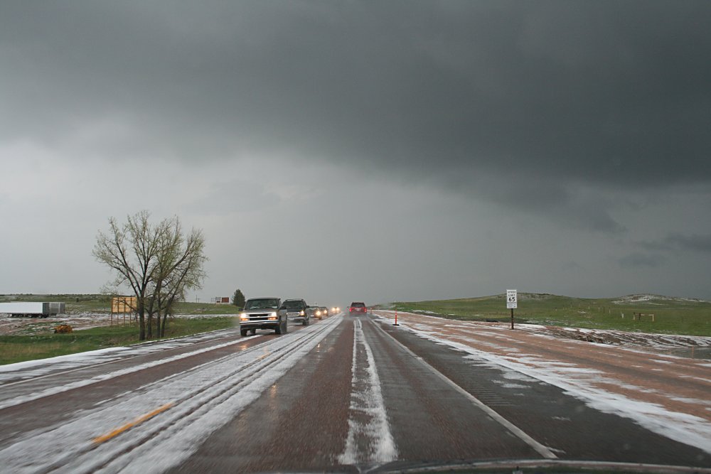
Hail coverage approaching Lusk from the north |
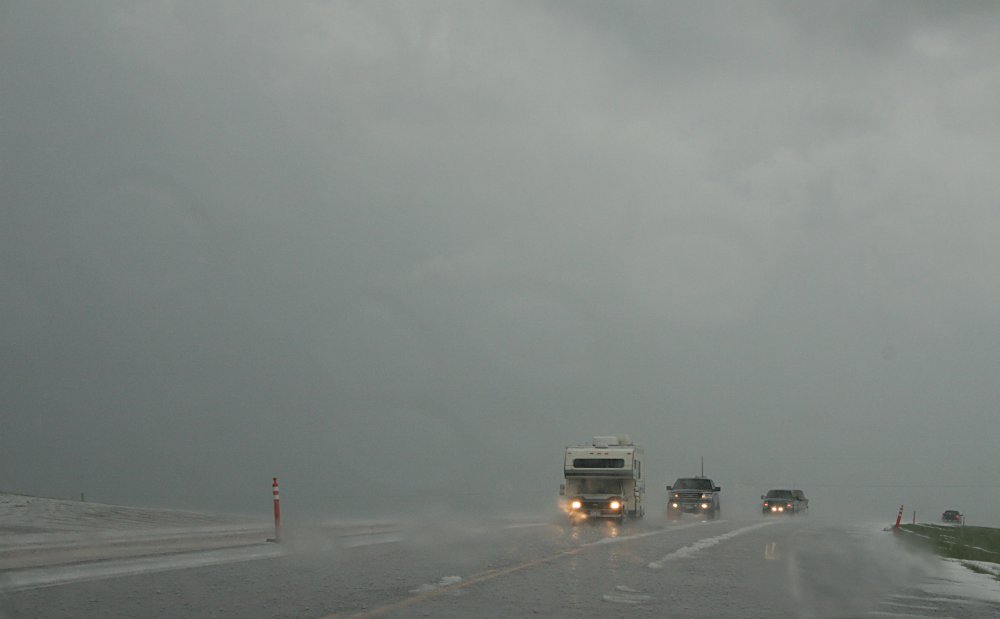 Traffic battling with icy roads |
 Hail swathe was about 1 mile wide - depths approached 4" near the centre of the swathe |
 Eastside of Lusk |
 |
 |
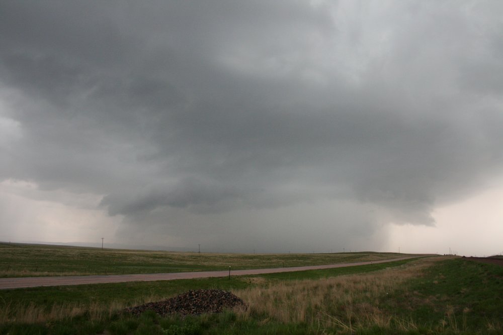
Decaying phase of storm southeast of Lusk |
 1 hour later, the storm was primary elevated to the mid levels and primarily outflow dominated, southeast of Lusk |
 |