| Stormchase
24th May 2009: Van Tassell, Wyoming to Scottsbluff, Nebraska Report: Clyve Herbert |
|
| We drive east
from Lusk heading for the Nebraska border - an alignment of strong multicells is moving
along the WY/NE border moving south to north. It is coming onto mid evening and light was
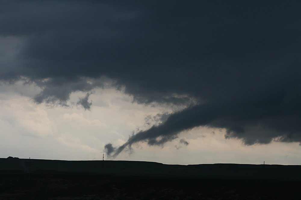
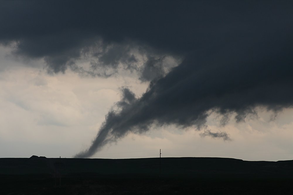
fading. After nearly 40 years of stormchasing, nature still manages to fool me occasionally.......as we approach Van Tassell, a tiny hamlet near the Nebraska border, we drive out from a deluging storm and discover its eastern side has a well developed gustfront. We drive east several miles to clear the rain to photograph the view. A smooth arcing gustfront was developing along a strengthening multicell alignment to our west. Looking towards the south, we were stunned to see what appeared to be a funnel descending to the ground. With the brain almost in panic overdrive, we start photographing and videoing in earnest! The development was occurring on the inflow on the far southern edge of the multicell line. Close examination showed that it was rotating slowly......we were totally sucked in! I became suspicious of the 'tube' when it aligned towards the arc of the gustfront...close examination showed it was not a tornado - at best, an extension of the gustfront rotating in a weak gustnado environment. The filament remained on the ground for almost 10 minutes before dissipating. We had never seen anything like this before!!!. We are also sure that it would have fooled the best of chasers for a short time. We continued east to Harrison where we encountered a collapsing cell with more hail and flash flooding, and drove south on Rte 20 heading for Scottsbluff, NE. Now late evening and in poor light, our NOAA radio beeped into life with a warning of severe storms near Scottsbluff. We encountered a very lightning active storm NW of Scottsbluff and watched it pass to the north with almost continuous thunder. With light now virtually gone we called it a day - so far our busiest storm day of the trip. Photography: Jane ONeill / Clyve Herbert |
|
 Strong multicell SW of Van Tassell, and developing condensation tube |
 Totally sucked in! At best, this turned our to be a weak gustnado ingesting moisture |
 Detail of tube |
 Close up image of condensation tube which was weakly rotating. |
 |
|
 Severe multicell storm near Scottsbluff, NE Severe multicell storm near Scottsbluff, NE |

|