| Stormchase
25th May 2009: 4 states & a mad last day - did we get storms? You betcha! Report: Clyve Herbert |
|
| We set off
from Scottsbluff with 2 plans - 1 was to catch early afternoon convection in central and
southeast Colorado, and the other was to line up later convection in the Texas panhandle.
In reality, it was stretching the possibilities..... This was to be our last American
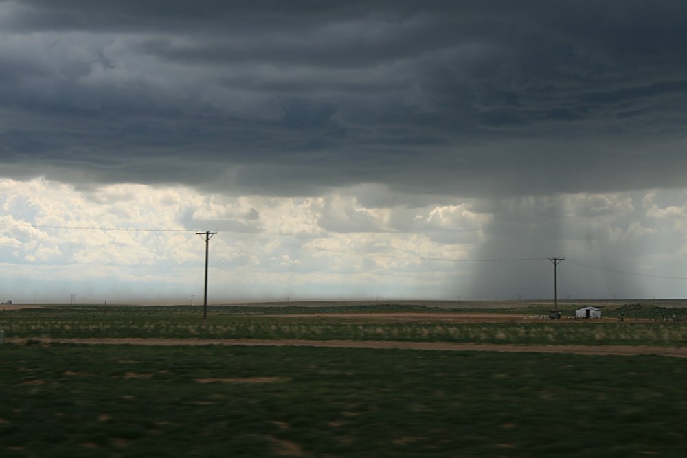
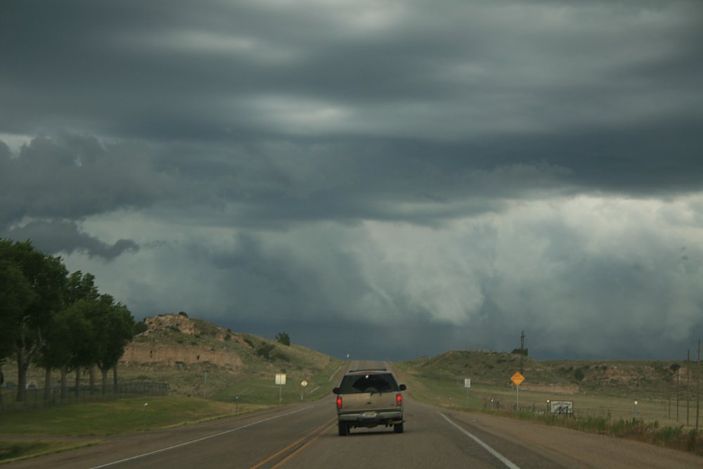
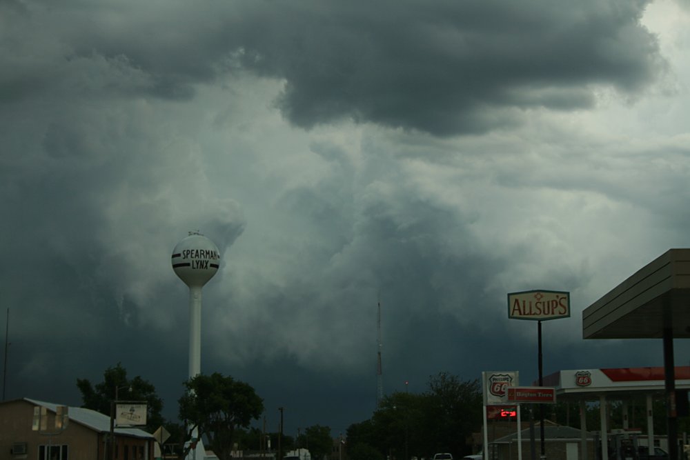
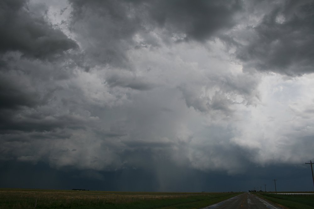
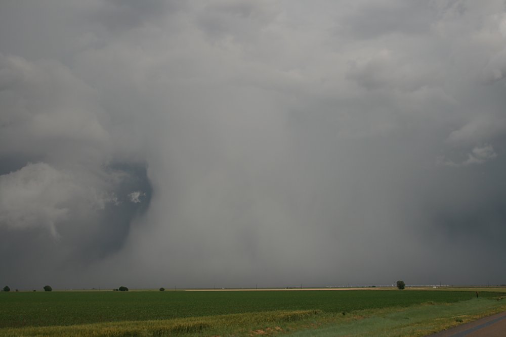
weather chase day - we were determined to get as many storms as we could. The synoptic setup saw a cold front dipping south through western NE overnight and steadily moving through CO in the afternoon to reach the OK panhandle towards evening. As it turned out, we ended up surfing the front/boundary all the way from east central CO to Pampa, TX over the next 10 hours. Convection didn't waste any time, we encountered multicell activity near Burlington by 11am - mainly disorganised multicells. We continued south to Cheyenne Wells by early afternoon and here we encountered more serious storm development. One of the storms became tornado warned to the northwest, whereas we tagged onto a storm near Cheyenne Wells - although it became severe it remained a strong multicell. Just south of Cheyenne Wells as this large multicell matured, a symmetrical vertical hole opened up on its southwest flank where all cloud disappeared (see pic). We suspect a rather strong RFD was located over our heads, and this was followed by a very strong and gusty microburst. The problem with these storms was the lack of shear and the frontal boundary continually overrunning the inflow source. We continued south from Cheyenne Wells as these storms became strongly outflow dominated. We more or less surfed the boundary south to Springfield, CO. Behind us, the boundary kept generating a line of strong multicells which occasionally took our attention. Although we were tempted at times to hang about, these storms were very pulsy in nature and soon collapsed. We made a definite plan now to follow our second choice and get into the TX panhandle before dark. We picked up a rapidly developing cell south of Springfield which only served to whet our appetite to get into the OK panhandle around Boise City where a large storm was moving northeast from the NW TX panhandle. Viewing south of Springfield to Boise City is great...we could see storm tops around us for hundreds of miles. We were a bit like kids in a candy shop! We noted that the Boise City storm was weakening as it moved northeast, however we suspected on its southern quadrant convection would continue on its outflow boundary. We passed through the OK panhandle and passed into Texas - our 4th state for the day!! Our theory that convection would remain on the southern quadrant proved correct...and this became a focus for intensification of storms near Spearman in the late evening. What we encountered was nothing short of awe inspiring!! East of Spearman, this line stepped up in strength so quickly you could literally see the tops bounce through the tropopause! We'd got ourselves into storm heaven.....Again the problem with these storms was the lack of shear, and we soon noticed the updrafts becoming enveloped in hail. The white shafts fell rapidly groundward producing hailfoots! We were stunned by the vista....one section of the convective line resisted the hail and developed a wallcloud underneath the base - it appeared to rotate but soon even this area of powerful updraft was swallowed up by an immense hailshaft. As the light faded, we could see almost continuous lightning flashing behind the hailshafts..we pulled over frequently to photograph, but soon we tried to escape...too late! We were caught up in one of the collapsing cells and struggled along the road to Pampa in a deluge of 2 - 4cm hail and continuous lightning (all on video). We survived the trip to Pampa only to be caught up with the fantastic display of strobe lightning and another hailstorm - by this time it was past midnight.......our 15 hour stormchase had come to an end. Report: Clyve Herbert Photography: Jane ONeill / Clyve Herbert |
|
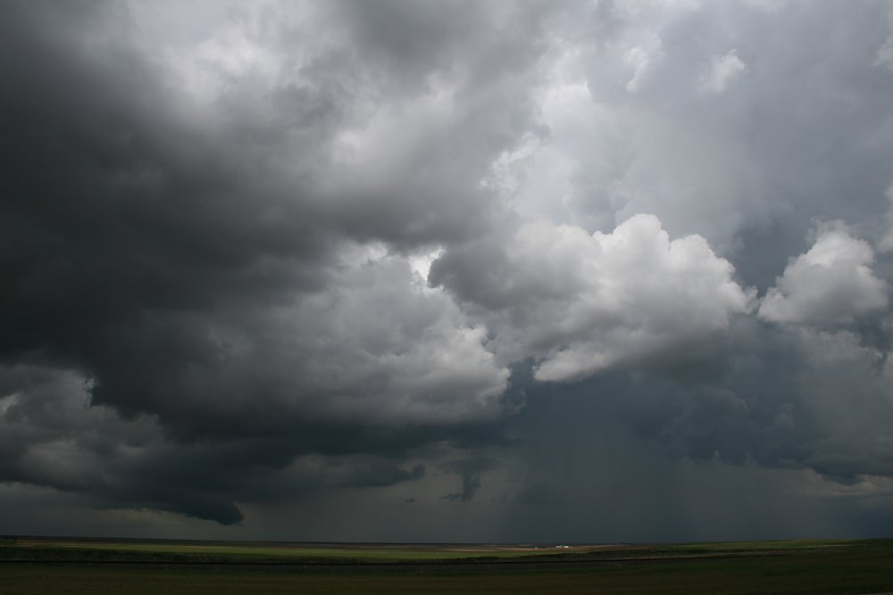 Cheyenne Wells storm |
 Suspected strong RFD hole, Cheyenne Wells |
 Cheyenne Wells |
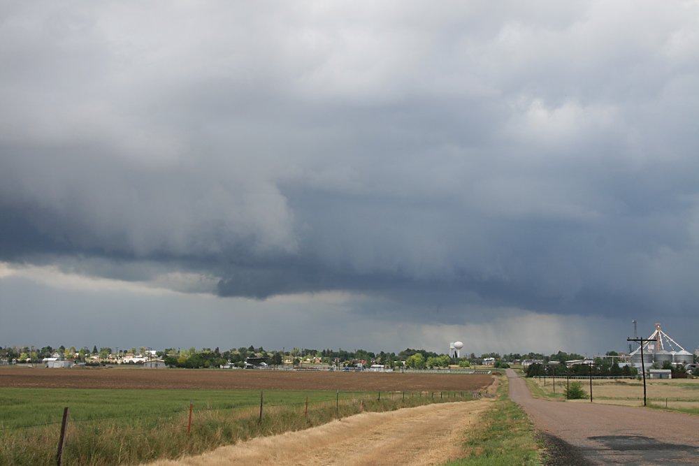 Cheyenne Wells |
 Arty farty storm pic, Cheyenne Wells |
 Pileus, Granada |
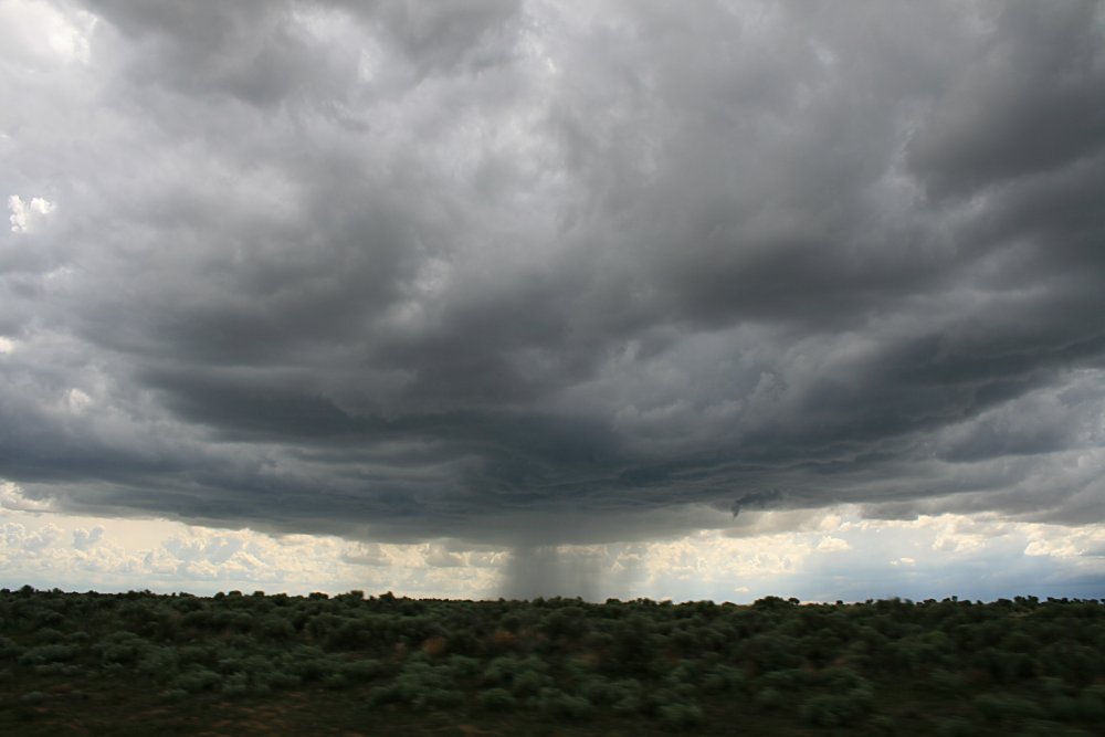 Standalone storm near Springfield |
 |
 Spearman storms get going, TX Panhandle |
 |
 Fantastic base features east of Spearman |
 Storm features, Spearman |
 Base features, east of Spearman |
 |
 |
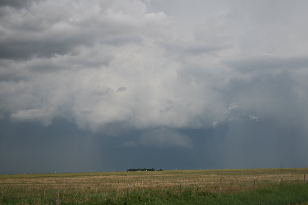 Strong updraft and wallcloud, we suspected rotation here |
 Stunning hailshafts east of Spearman |
 |
 |
 |