| There's one thing you hardly notice
when you are heading to western Kansas....and that's the very gentle slope in elevation.
As you leave I35 and head west you rise from near 1,500' to near 4,000' near the far
western Kansas - Colorado border. The incline is so gradual and with the lack of anything
that remotely looks like a mountain, the rise is deceptive. When it comes to weather,
altitude in western Kansas has a great influence. This is where the Colorado high plains
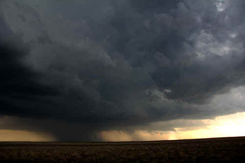
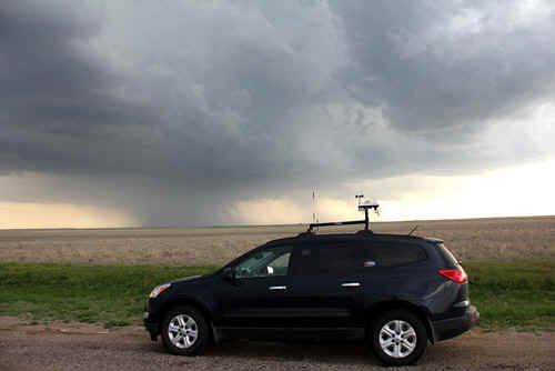
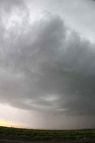
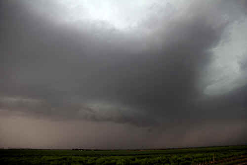
supercells can dribble across the border and become tornadic. Today we are heading for SW Kansas - the countryside in far SW Kansas is decidedly semi-arid. There's lots of irrigation with a mix of wheat and corn. Winters here can be harsh but dry with extreme cold. During the spring and summer months, sporadic invasions of moisture from the Gulf can bring spectacular storms. This is where the elevation plays its trick....low pressure systems dribbling in from the Pacific tend to be broken apart by the Rockies, but their upper counterparts tend to find their way to the lee side of the Rocky Mountains. The favoured path of some of the southern extensions of Pacific storms is through Utah and New Mexico where they rotate across the Texas Panhandle and into Oklahoma. Moisture from the Gulf can then upslide in a southeasterly surge across western Kansas - this is known as isentropic lifting. The added altitude of western Kansas can often mean that storms can develop here but not over lower elevations. As we head SW through Greensburg spotting trains and altocumulus, we can see way off in the Texas Panhandle we can see the first storm anvils. Convection is enhancing along a dryline and an upper trough that is moving quickly northeast.Despite dewpoints in the high 40's and low 50's, a narrow tongue of higher dewpoints is spreading NW from Oklahoma into SW Kansas and mixing ahead of the dryline.Pretty soon we are approaching the Oklahoma Panhandle - a weird strip of land that no-one else wanted...Oklahoma got it! It's a mix of prairie, scrub and the odd mesa. By late afternoon a massive anvil had spread across the Oklahoma Panhandle and SW Kansas.These high plains storms generate huge anvils even though their updraft cores are relatively small....makes them photogenic! As we approach Guymon, we can see the main updraft core to our northwest...the bulk of roads in this part of America are a mix of dirt and bitumen...we avoid the dirt county roads as they turn into quagmires even with a small amount of rain. The storm we are approaching has the look of a supercell...it has an attendant mesocyclone which can be seen rotating on its western flank. The precipitation core is barely a few miles wide...the storm is moving NE at between 40 and 50mph. We race northwest to come back around the mesocyclone...and photograph the immense structure of a high plains supercell. We are overrun briefly by a 60 knot outflow gust and follow the storm NE to Elkhart. It's here that we get pummelled by the RFD (rear flank downdraft) and we get a view of the rotating wallcloud just west of Elkhart. Occasionally the wallcloud resolves into a broad funnel, but this storm clearly has difficulties with setting down a tornado. The wall area shrinks and increases in size reflecting the pulsy nature of the storm. Its interesting to note the development of inflow bands into these storms. This storm evolves 3 inflow bands...drawing rather more stable air on its eastern flank, while another ragged beavertail points SW. Just near sunset the storm collapses and merges with other cells developing to the west to form a large rain area. We overnight at Garden City, which always has an attendant smell caused by feedlots, but the Comfort Inn there is topnotch with good beds and a hot breakfast. |
|
 Eastbound UP freighter near Greensburg KS Photo: Jane ONeill |
 4 Goliaths back onto their train, SW Kansas (Indian Pacific) Photo: Jane ONeill |
 Spectacular altocumulus arrangement near Greensburg, Altocumulus castellanus lenticularis (midlevels conditionally unstable) Photo: Jane ONeill
|
 |
 Approaching high plains developing supercell near Guymon, Oklahoma Panhandle Photo: Clyve Herbert |
 A relatively small updraft in comparison to the massive anvil Photo: Clyve Herbert |
|
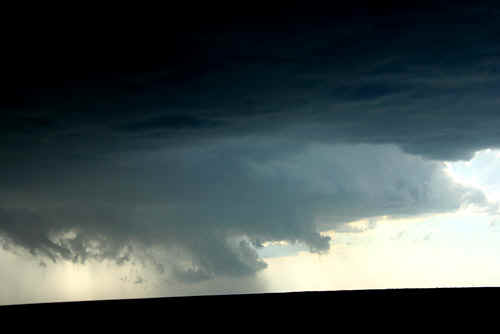
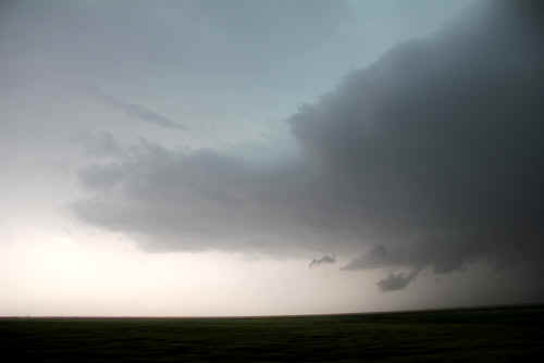
 About 70 miles to our north, the eastern Colorado supercell pushes up an enormous overshoot...note the protrusions on the left side where the updraft is squashed into a backshear by the tropopause.... Photo: Jane ONeill |
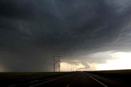
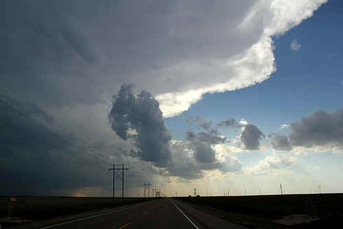 Nothing like driving under a rock solid, sharply defined anvil on a good storm road. Photo: Jane ONeill |
|
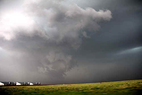
 Trying to beat the precipitation core to get to the mesocyclone which can be seen on the west side. Photo: Clyve Herbert |
A closer view of the intense precipitation core near Guymon. 2-4cm hail accompanied this storm Photo: Jane ONeill |
|
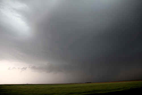
This is the mesocyclone located on the west side showing broad rotation and under the main updraft. Photo: Clyve Herbert |
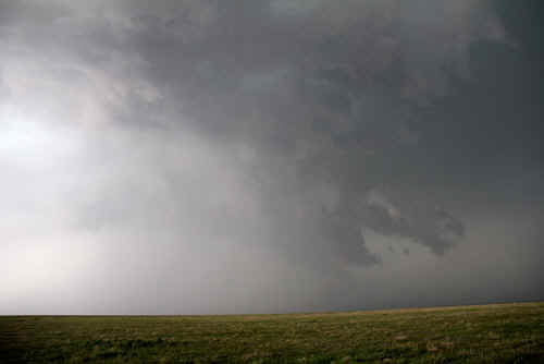
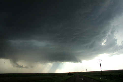 A closer view of the wall area and mesocyclone. Photo: Clyve Herbert |
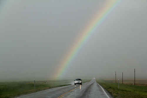 Nice rainbow! Photo: Jane ONeill |
 60 knot low level outflow gust Photo: Jane ONeill |
 Rain partially hides the main updraft core near Elkhart.Photo: Jane ONeill |
 Broad rotating funnel near Elkhart. The RFD was wrapping rain on the left side. Photo: Clyve Herbert |
 Rotating wallcloud NE of Elkhart. Photo: Clyve Herbert |
 The storm develops several inflow bands on its southern and eastern sides. This was the primary inflow band. Photo: Clyve Herbert |
 Rotating wall area. We paced the storm NE along a handy road that paralleled the storm track. Photo: Clyve Herbert |
 |
 Rain wrapping in around the wallcloud. Photo: Clyve Herbert |
 Smooth base of an east side inflow band. Photo: Jane ONeill |
 Later in the evening the storm retains its inflow bands even in a weakening phase. The cell collapsed not long after these photos.Photo: Clyve Herbert |
|
| Stay tuned for the next episode... | |