Bendigo Storms 30th December 2003 Clyve Herbert
|
|||
ABSTRACT On 30/12/2003, a band of mid levels storms unexpectedly developed west and northwest of Bendigo producing fierce downbursts and local flashflooding. Damage was sustained over the greater Bendigo area, thus bringing to an end a very weather active year for Bendigo. These unexpected storms developed along a narrow trough moving through the region which interacted with a tongue of mid level moisture spreading southeast from South Australia. The storm development is a good example of activity when elevated moisture is advected into a previously very dry environment and mixes with daytime maximums near 40�C and the timely passage of the additional forcing structure of a trough... Extensive and energetic downbursts were common with these storms as rain falling from elevated storm cells evaporated in very dry air below 7000feet. As the storm band moved eastward, an opportunity to photograph receding multi cells in the setting sun allowed that rare occasion to see the rich detail of these storms. |
|||
|
Image of Bridgwater on Loddon, northwest of Bendigo showing mid level vorticity on the rear of a cell. |
|||

|
 Series of 4 images above � Clyve Herbert
|

|
|
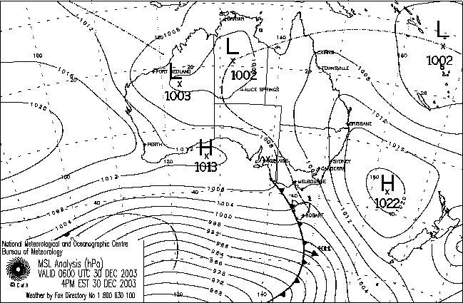 4pm 30/12/2003 MSL |
 8pm 30/12/2003 JCU IR image
|
||
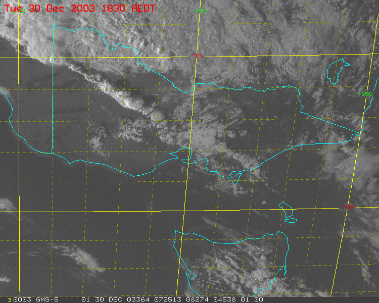  Amplification of cloud line associated with thunderstorm development over north central and northwest Victoria on 30/12/2003 |
|||
 IR loop SE Australia (click for loop) |
Radar loop - Melbourne 256k 30/12/2003 (click for loop) |
||
 Bendigo Advertiser 31/12/2003 |
Other information Taken from Melbourne looking towards Bendigo, image courtesy of David Simpson
Bendigo Advertiser article - printed 31/12/2003 Bendigo Surface Oberservations (30/12/2003) |
||


